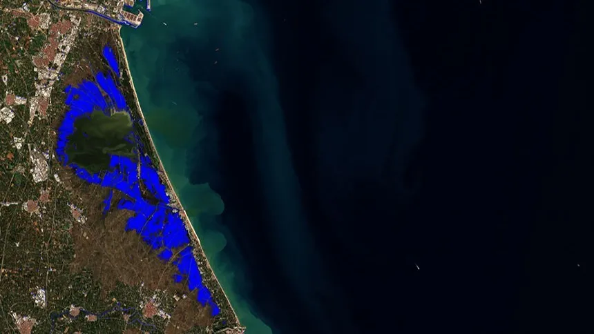
The work, led by professor José Antonio Sobrino and involving researcher Yves Julien, employs remote sensing techniques to observe territorial changes. Images from September 8 and October 21, 2026, captured by the European Space Agency's (ESA) Sentinel-2 satellite, were compared.
To identify the flooded areas, the normalized difference water index (NDWI) was calculated, a tool that helps distinguish water surfaces. The result provides a spatial overview of the affected areas, guiding future, more detailed ground-based assessments.
The research team warns that the figure of 67 sq km is a preliminary estimate. Approximately 22 sq km of rice paddies were already flooded before the storm, meaning the detected area cannot be entirely attributed to the DANA. Furthermore, the images were taken three days after the most intense rainfall, by which time some water may have already receded.
Remote sensing proves to be a valuable tool for assessing extreme phenomena, assisting administrations in identifying areas requiring inspection and facilitating damage assessment. This research is part of the activities of the Global Change Unit at the University of Valencia, which has been studying environmental variations using remote sensing since 1996.